I thought I would post photos from Oregon and Washington separately and write a recap of each state. This would benefit me as well as anyone who's actually reading the blog. I haven't kept a journal so assuming google stores the blog for a long time I can return to it and remember some of the adventure. These entries will be a little rambling, but I think all of my entries have been like that anyway.
After Gretchen visited me at Crater Lake, she dropped me off where I stopped the northward march. I had said it would be futile to try and catch my friends, who were now two full days ahead. But that's exactly what I attempted to do, largely because I was more or less in a small bubble with no thru-hikers. We busted through northern California and southern Oregon so fast that we were about 5-7 days ahead of the main pack of hikers. So as soon as I got back on the trail, I was more or less alone. I would pass a few other thru-hikers, but no one moving at my pace so I would simply keep moving all day. So when I got on trail, I had two full days to make up or pretty much 60 miles, in order to catch my buds who were hiking at my pace. I started busting out ridiculous days, trying to hit at least 35 miles a day. I did 38 miles one day, which ended up being the most I did on the entire trip, but it did catch up with me. I slightly injured my ankle, and initially I thought it might be the end up my trip, Fortunately, I was more worried about it than necessary and after taping it up it healed by the time I made it to the Oregon-Washington border.
Eventually I did catch several of my friends and made some new ones in Cascade Locks. I did end up hiking more or less 320 miles solo. I'd cross paths with other dayhikers, southbounders, and slower thru-hikers, but these were just short interactions. I did cross paths with Asabat between Charlton Lake and Irish and Turner Lakes at about 7 PM or so (I may have the lake names a little goofed). We talked for a few minutes about our day and who we had seen. Asabat compiles the water report for southern California which is totally invaluable for us thru-hikers. It was crazy to run into him on the trail. I found out about a week later that Asabat had passed away that same night at Charlton Lake in his tent. He was an older gentleman, but when I saw him he looked ok to me, definitely not like someone about to pass away. Last I heard it was natural causes; they found him in his tent when his wife reported he did not show up when expected. It felt strange knowing that I must have been one of the last to ever speak with him and see him alive.
I had started wondering if Oregon scenery was going to improve, and then I hit the Three Sisters Wilderness. Wildflowers were in full bloom as I hiked alongside three 10,000 ft volcanoes. I was simply blown away and then on the north side of Three Sisters the trail goes through expansive lava flows. I had no idea it was coming, so it was a huge surprise. It made for dramatic scenery, but it was a little hard to walk through, especially with my ankle being injured at the time. I also got some awesome trail magic from Legosaurus and Pocohontas at the Lava Lake campground.
After the lava field it seemed a large part of Oregon seemed to follow a pattern: seemingly endless walking through the landmark-less woods, traverse around an old cascade volcano, and back to the woods again. Below I don't really show any photos of the wooded sections. While pretty, they would get tedious and without any significant features or landmarks, it could get difficult at times to determine exactly where I was at on the map. Sometimes I would wonder if I had missed a trail junction and was even on the correct trail. Fortunately, I never did get lost on the PCT. But that's because I check my map every 5-10 minutes and track where I think I'm at. I never took a GPS, and for the most part I didn't regret not carrying one.
At one point it could have come in handy, but in the end I was ok. I had intended to camp in Jefferson Park on the north side of Mt Jefferson. When I got there though, I got my first glimpse of the Waterfall 2 fire. It made me very nervous and stressed. No one else was around in what would is normally a high use camping area. While the fire was about a mile away, it made me very uncomfortable, so I chose to push north for fear of a trail closure that would prevent me from doing a full thru-hike more than fear of being hurt or killed by a wildfire. So I pushed on only to be greeted by a huge snowfield. This was the only snowfield that was big enough to cause me to lose the trail. It was a beauitful sight to finally see that much snow on the trail and to have my first distant view of Mt Hood. But the trail in the snow quickly petered out, and I couldn't tell where to go due to the limited detail on my map. So there I was, the sun was quickly setting, there was the specter of a wildfire hanging in the back of my mind and in sight, and I couldn't follow the trail. It was a little stressful, and my fallback plan was to reclimb the ridge and camp there if I couldn't find the trail in the next few minutes. Fortunately, I was finally able to spot some cairns and once low enough found the trail. I set up camp within sight of the wildfire which was strange. Within the next 3-5 days, the Waterfall 2 fire closed the PCT in this area, so I was fortunate to get through when I did.
When I made it to Timberline Lodge, I caught up with the Beards and Bronco. Bronco had a room at Timberline Lodge, and he ended up letting me crash on the floor. The lodge is a gorgeous building built by the Civilian Conservation Corp during the Great Depression, I believe. The exterior of the building was used the film adaptation of Stephen King's The Shining. If you ever there, get the breakfast buffet. It is great great, especially for $15.
Mt Hood was beautiful as are all the Cascade Volcanoes. North of Mt Hood, thru-hikers can take an alternative trail. Most thru-hikers descend to the Columbia River Gorge to Cascade Locks via Eagle Creek rather than taking the official PCT which is further east. Eagle Creek flows through a beautiful canyon with several waterfalls. Below are two photos of Tunnel Falls behind which the trail actually goes. It's very beautiful, but it's also very touristy. It gets very frustrating trying to hike with big crowds around. Tourists aren't very courteous and don't follow hiking etiquette. These areas tend to have lots of garbage despite the unusually beautiful scenery. Unfortunately, Eagle Creek was no different from most of these uber-popular tourist trails. It's a common hiker complaint, so I think in the end most of us that went down Eagle Creek could have done without it. After Eagle Creek, I reached Cascade Locks and caught up with several friends. I zeroed in Cascade Locks to give my ankle time to rest although I think it was 100% by then. I was definitely happy to say goodbye to Oregon and move on to Washington, which ended up being my favorite part of the trail.
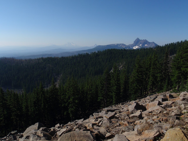
View to the north including Diamond Peak, Mt Thielsen an the distant Three Sisters
Mt Thielsen (The Lightning Rod of the Cascades)
Diamond View Lake
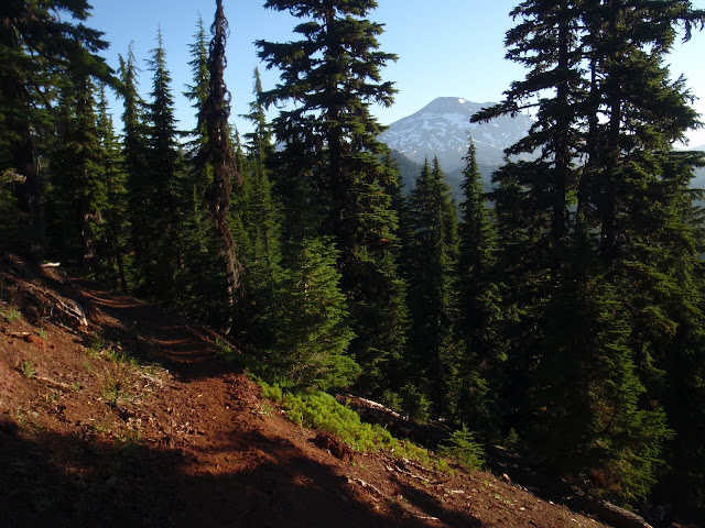
Typical view in the woods in Oregon. There was a lot of this in OR.
The South Sister
I believe this is the Middle Sister
View to the north including Mt Washington, Three Fingered Jack, and Mt Jefferson
Impressive Lava Fields
View to the north including Mt Washington, Three Fingered Jack, and Mt Jefferson
View to south across lava fields north of the Three Sisters
North side of Three Fingered Jack with its beautiful layers
View to the south including Three Fingered Jack, Mt Washington and the Three Sisters
South side of Mt Jefferson
My first view of the Waterfall 2 fire from Jefferson Park.
North side of Mt Jefferson
View north to Mt Hood. There is where I had to spend some time to look for the trail in the snow.
Waterfall 2 fire - you can see a few trees on fire.
The Waterfall 2 fire greets me in the morning
South side of Mt Hood
Mt Hood from a brutally sandy and steep section of trail
North side of Mt Hood
North side of Mt Hood
Tunnel Falls along Eagle Creek
The old locks at Cascade Locks on the Columbia River
Bridge of the Gods


No comments:
Post a Comment